Maps showing Rivière Rouge, Grenville-sur-la-Rouge; Argenteuil, Quebec
Rivière Rouge is a River located in Grenville-sur-la-Rouge; Argenteuil, Quebec and has an elevation of 219 meters.
- Latitude: 45° 38' 34'' North (decimal: 45.6428246)
- Longitude: 74° 41' 29'' West (decimal: -74.6912951)
- Topography Feature Category: River
- Geographical Feature: Rivière
- Canadian Province/Territory: Quebec
- Elevation: 219 meters
- Location: Grenville-sur-la-Rouge; Argenteuil
- Atlas of Canada Locator Map: Rivière Rouge
- GPS Coordinate Locator Map: Rivière Rouge Lat/Long
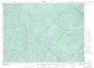
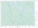
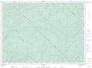
Rivière Rouge NTS Map Sheets
031G10 Hawkesbury Topographic Map at 1:50,000 scale
031G15 Arundel Topographic Map at 1:50,000 scale
031J01 Sainte-Agathe-Des-Monts Topographic Map at 1:50,000 scale
031J02 Saint-Jovite Topographic Map at 1:50,000 scale
031J07 L'Annonciation Topographic Map at 1:50,000 scale
031J10 L'Ascension Topographic Map at 1:50,000 scale
031J15 Lac De La Maison De Pierre Topographic Map at 1:50,000 scale
031O01 Lac Troyes Topographic Map at 1:50,000 scale
031O02 Lac Pine Topographic Map at 1:50,000 scale
031G Ottawa Topographic Map at 1:250,000 scale
031J Mont-Laurier Topographic Map at 1:250,000 scale
031O Lac Kempt Topographic Map at 1:250,000 scale