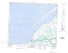
Maps showing Pointe au Sable, Kuujjuarapik; Kativik, Quebec
Pointe au Sable is a Cape located in Kuujjuarapik; Kativik, Quebec and has an elevation of 1 meters.
- Latitude: 55° 16' 11'' North (decimal: 55.2695948)
- Longitude: 77° 46' 57'' West (decimal: -77.7825315)
- Topography Feature Category: Cape
- Geographical Feature: Pointe
- Canadian Province/Territory: Quebec
- Elevation: 1 meters
- Location: Kuujjuarapik; Kativik
- Atlas of Canada Locator Map: Pointe au Sable
- GPS Coordinate Locator Map: Pointe au Sable Lat/Long
Pointe au Sable NTS Map Sheets