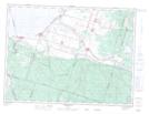
Maps showing Saint-André-du-Lac-Saint-Jean, Saint-André-du-Lac-Saint-Jean; Le Domaine-du-Roy, Quebec
Saint-André-du-Lac-Saint-Jean is a Town located in Saint-André-du-Lac-Saint-Jean; Le Domaine-du-Roy, Quebec and has an elevation of 284 meters.
- Latitude: 48° 19' North (decimal: 48.3166666)
- Longitude: 71° 59' West (decimal: -71.9833333)
- Topography Feature Category: Town
- Geographical Feature: Municipalité de village
- Canadian Province/Territory: Quebec
- Elevation: 284 meters
- Location: Saint-André-du-Lac-Saint-Jean; Le Domaine-du-Roy
- Atlas of Canada Locator Map: Saint-André-du-Lac-Saint-Jean
- GPS Coordinate Locator Map: Saint-André-du-Lac-Saint-Jean Lat/Long
Saint-André-du-Lac-Saint-Jean NTS Map Sheets