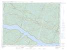
Maps showing Île Saint-Barthélemy, Sacré-C¿ur; La Haute-Côte-Nord, Quebec
Île Saint-Barthélemy is a Island located in Sacré-C¿ur; La Haute-Côte-Nord, Quebec and has an elevation of 59 meters.
- Latitude: 48° 15' 50'' North (decimal: 48.2639128)
- Longitude: 70° 2' 36'' West (decimal: -70.0433925)
- Topography Feature Category: Island
- Geographical Feature: Île / Ile
- Canadian Province/Territory: Quebec
- Elevation: 59 meters
- Location: Sacré-C¿ur; La Haute-Côte-Nord
- Atlas of Canada Locator Map: Île Saint-Barthélemy
- GPS Coordinate Locator Map: Île Saint-Barthélemy Lat/Long
Île Saint-Barthélemy NTS Map Sheets