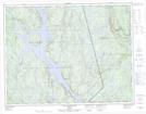
Maps showing Barrage Sainte-Anne, Rivière-aux-Outardes; Manicouagan, Quebec
Barrage Sainte-Anne is a Hydraulic construction located in Rivière-aux-Outardes; Manicouagan, Quebec and has an elevation of 295 meters.
- Latitude: 50° 6' 10'' North (decimal: 50.1028172)
- Longitude: 67° 56' 32'' West (decimal: -67.9422546)
- Topography Feature Category: Hydraulic construction
- Geographical Feature: Barrage
- Canadian Province/Territory: Quebec
- Elevation: 295 meters
- Location: Rivière-aux-Outardes; Manicouagan
- Atlas of Canada Locator Map: Barrage Sainte-Anne
- GPS Coordinate Locator Map: Barrage Sainte-Anne Lat/Long
Barrage Sainte-Anne NTS Map Sheets