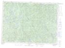
Maps showing Lac Saint-Étienne, Lac-Croche; La Jacques-Cartier, Quebec
Lac Saint-Étienne is a Lake located in Lac-Croche; La Jacques-Cartier, Quebec.
- Latitude: 47° 36' 35'' North (decimal: 47.6097222)
- Longitude: 71° 57' 6'' West (decimal: -71.9516667)
- Topography Feature Category: Lake
- Geographical Feature: Lac
- Canadian Province/Territory: Quebec
- Location: Lac-Croche; La Jacques-Cartier
- GPS Coordinate Locator Map: Lac Saint-Étienne Lat/Long
Lac Saint-Étienne NTS Map Sheets