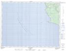
Maps showing Sandy Cliff, L'Île-d'Anticosti; Minganie, Quebec
Sandy Cliff is a Cape located in L'Île-d'Anticosti; Minganie, Quebec.
- Latitude: 49° 29' 24'' North (decimal: 49.49)
- Longitude: 63° 37' 3'' West (decimal: -63.6175)
- Topography Feature Category: Cape
- Geographical Feature: Cap
- Canadian Province/Territory: Quebec
- Location: L'Île-d'Anticosti; Minganie
- GPS Coordinate Locator Map: Sandy Cliff Lat/Long
Sandy Cliff NTS Map Sheets