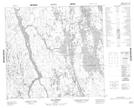
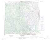
Maps showing Sangumaniq, Rivière-Koksoak; Kativik, Quebec
Sangumaniq is a Unincorporated area located in Rivière-Koksoak; Kativik, Quebec.
- Latitude: 57° 33' 2'' North (decimal: 57.5505556)
- Longitude: 67° 19' 56'' West (decimal: -67.3322222)
- Topography Feature Category: Unincorporated area
- Geographical Feature: Lieu-dit
- Canadian Province/Territory: Quebec
- Location: Rivière-Koksoak; Kativik
- Atlas of Canada Locator Map: Sangumaniq
- GPS Coordinate Locator Map: Sangumaniq Lat/Long
Sangumaniq NTS Map Sheets