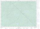
Maps showing Ruisseau Santelles, Lac-Bazinet; Antoine-Labelle, Quebec
Ruisseau Santelles is a River located in Lac-Bazinet; Antoine-Labelle, Quebec.
- Latitude: 47° 43' 7'' North (decimal: 47.7186812)
- Longitude: 74° 51' 34'' West (decimal: -74.8593181)
- Topography Feature Category: River
- Geographical Feature: Ruisseau
- Canadian Province/Territory: Quebec
- Location: Lac-Bazinet; Antoine-Labelle
- GPS Coordinate Locator Map: Ruisseau Santelles Lat/Long
Ruisseau Santelles NTS Map Sheets