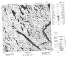
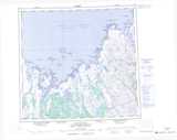
Maps showing Rapides Sarvaaluk, Rivière-Koksoak; Kativik, Quebec
Rapides Sarvaaluk is a Rapids located in Rivière-Koksoak; Kativik, Quebec.
- Latitude: 58° 29' 32'' North (decimal: 58.4922222)
- Longitude: 66° 0' 38'' West (decimal: -66.0105556)
- Topography Feature Category: Rapids
- Geographical Feature: Rapides
- Canadian Province/Territory: Quebec
- Location: Rivière-Koksoak; Kativik
- Atlas of Canada Locator Map: Rapides Sarvaaluk
- GPS Coordinate Locator Map: Rapides Sarvaaluk Lat/Long
Rapides Sarvaaluk NTS Map Sheets