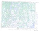
Maps showing Île du Sauvage, Petit-Mécatina; Minganie, Quebec
Île du Sauvage is a Island located in Petit-Mécatina; Minganie, Quebec and has an elevation of 36 meters.
- Latitude: 50° 42' 55'' North (decimal: 50.7153370)
- Longitude: 59° 35' 41'' West (decimal: -59.5947083)
- Topography Feature Category: Island
- Geographical Feature: Île / Ile
- Canadian Province/Territory: Quebec
- Elevation: 36 meters
- Location: Petit-Mécatina; Minganie
- Atlas of Canada Locator Map: Île du Sauvage
- GPS Coordinate Locator Map: Île du Sauvage Lat/Long
Île du Sauvage NTS Map Sheets