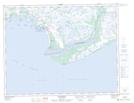
Maps showing Pointe au Sauvage, Aguanish; Minganie, Quebec
Pointe au Sauvage is a Cape located in Aguanish; Minganie, Quebec and has an elevation of 0 meters.
- Latitude: 50° 13' 5'' North (decimal: 50.2181278)
- Longitude: 61° 55' 30'' West (decimal: -61.9250950)
- Topography Feature Category: Cape
- Geographical Feature: Pointe
- Canadian Province/Territory: Quebec
- Elevation: 0 meters
- Location: Aguanish; Minganie
- Atlas of Canada Locator Map: Pointe au Sauvage
- GPS Coordinate Locator Map: Pointe au Sauvage Lat/Long
Pointe au Sauvage NTS Map Sheets