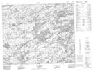
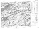
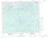
Maps showing Lac Sauvolles, Baie-James; Jamésie, Quebec
Lac Sauvolles is a Lake located in Baie-James; Jamésie, Quebec.
- Latitude: 53° 25' 50'' North (decimal: 53.4305556)
- Longitude: 72° 56' 29'' West (decimal: -72.9413889)
- Topography Feature Category: Lake
- Geographical Feature: Lac
- Canadian Province/Territory: Quebec
- Location: Baie-James; Jamésie
- Atlas of Canada Locator Map: Lac Sauvolles
- GPS Coordinate Locator Map: Lac Sauvolles Lat/Long
Lac Sauvolles NTS Map Sheets