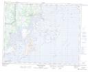
Maps showing Rochers Seal, Gros-Mécatina; Basse-Côte-Nord, Quebec
Rochers Seal is a Island located in Gros-Mécatina; Basse-Côte-Nord, Quebec and has an elevation of 2 meters.
- Latitude: 50° 45' 2'' North (decimal: 50.7506114)
- Longitude: 59° 0' 46'' West (decimal: -59.0127405)
- Topography Feature Category: Island
- Geographical Feature: Rochers
- Canadian Province/Territory: Quebec
- Elevation: 2 meters
- Location: Gros-Mécatina; Basse-Côte-Nord
- Atlas of Canada Locator Map: Rochers Seal
- GPS Coordinate Locator Map: Rochers Seal Lat/Long
Rochers Seal NTS Map Sheets