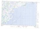
Maps showing Pointe Sealnet, Côte-Nord-du-Golfe-du-Saint-Laurent; Basse-Côte-Nord, Quebec
Pointe Sealnet is a Cape located in Côte-Nord-du-Golfe-du-Saint-Laurent; Basse-Côte-Nord, Quebec and has an elevation of 0 meters.
- Latitude: 50° 20' 28'' North (decimal: 50.3411698)
- Longitude: 59° 48' 37'' West (decimal: -59.8102859)
- Topography Feature Category: Cape
- Geographical Feature: Pointe
- Canadian Province/Territory: Quebec
- Elevation: 0 meters
- Location: Côte-Nord-du-Golfe-du-Saint-Laurent; Basse-Côte-Nord
- Atlas of Canada Locator Map: Pointe Sealnet
- GPS Coordinate Locator Map: Pointe Sealnet Lat/Long
Pointe Sealnet NTS Map Sheets