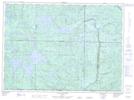
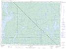
Maps showing Lac Serein, Lac-Pythonga; La Vallée-de-la-Gatineau, Quebec
Lac Serein is a Lake located in Lac-Pythonga; La Vallée-de-la-Gatineau, Quebec and has an elevation of 470 meters.
- Latitude: 47° 14' 56'' North (decimal: 47.2488889)
- Longitude: 76° 12' 29'' West (decimal: -76.2080556)
- Topography Feature Category: Lake
- Geographical Feature: Lac
- Canadian Province/Territory: Quebec
- Elevation: 470 meters
- Location: Lac-Pythonga; La Vallée-de-la-Gatineau
- Atlas of Canada Locator Map: Lac Serein
- GPS Coordinate Locator Map: Lac Serein Lat/Long
Lac Serein NTS Map Sheets