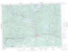
Maps showing Ruisseau Serpent, Rivière-Kipawa; Témiscamingue, Quebec
Ruisseau Serpent is a River located in Rivière-Kipawa; Témiscamingue, Quebec and has an elevation of 238 meters.
- Latitude: 46° 25' 42'' North (decimal: 46.4283894)
- Longitude: 78° 48' 32'' West (decimal: -78.8089567)
- Topography Feature Category: River
- Geographical Feature: Ruisseau
- Canadian Province/Territory: Quebec
- Elevation: 238 meters
- Location: Rivière-Kipawa; Témiscamingue
- Atlas of Canada Locator Map: Ruisseau Serpent
- GPS Coordinate Locator Map: Ruisseau Serpent Lat/Long
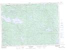
Ruisseau Serpent NTS Map Sheets