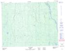
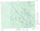
Maps showing Île des Sept Milles, Baie-James; Jamésie, Quebec
Île des Sept Milles is a Island located in Baie-James; Jamésie, Quebec and has an elevation of 121 meters.
- Latitude: 50° 32' 39'' North (decimal: 50.5441666)
- Longitude: 79° 7' 54'' West (decimal: -79.1316666)
- Topography Feature Category: Island
- Geographical Feature: Île / Ile
- Canadian Province/Territory: Quebec
- Elevation: 121 meters
- Location: Baie-James; Jamésie
- Atlas of Canada Locator Map: Île des Sept Milles
- GPS Coordinate Locator Map: Île des Sept Milles Lat/Long
Île des Sept Milles NTS Map Sheets