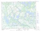
Maps showing Lac Simard, Petit-Mécatina; Minganie, Quebec
Lac Simard is a Lake located in Petit-Mécatina; Minganie, Quebec and has an elevation of 42 meters.
- Latitude: 50° 17' 24'' North (decimal: 50.2900699)
- Longitude: 61° 20' 26'' West (decimal: -61.3406280)
- Topography Feature Category: Lake
- Geographical Feature: Lac
- Canadian Province/Territory: Quebec
- Elevation: 42 meters
- Location: Petit-Mécatina; Minganie
- Atlas of Canada Locator Map: Lac Simard
- GPS Coordinate Locator Map: Lac Simard Lat/Long
Lac Simard NTS Map Sheets