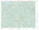
Maps showing Rivière Simard, Rivière-aux-Outardes; Manicouagan, Quebec
Rivière Simard is a River located in Rivière-aux-Outardes; Manicouagan, Quebec.
- Latitude: 49° 41' 45'' North (decimal: 49.6958333)
- Longitude: 68° 36' 17'' West (decimal: -68.6047222)
- Topography Feature Category: River
- Geographical Feature: Rivière
- Canadian Province/Territory: Quebec
- Location: Rivière-aux-Outardes; Manicouagan
- GPS Coordinate Locator Map: Rivière Simard Lat/Long
Rivière Simard NTS Map Sheets