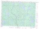
Maps showing Lac Skead, Rivière-Kipawa; Témiscamingue, Quebec
Lac Skead is a Lake located in Rivière-Kipawa; Témiscamingue, Quebec and has an elevation of 355 meters.
- Latitude: 46° 39' 58'' North (decimal: 46.6661693)
- Longitude: 77° 54' 57'' West (decimal: -77.9158656)
- Topography Feature Category: Lake
- Geographical Feature: Lac
- Canadian Province/Territory: Quebec
- Elevation: 355 meters
- Location: Rivière-Kipawa; Témiscamingue
- Atlas of Canada Locator Map: Lac Skead
- GPS Coordinate Locator Map: Lac Skead Lat/Long
Lac Skead NTS Map Sheets