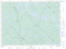
Maps showing Lac Sleeve, Baie-de-la-Bouteille; Matawinie, Quebec
Lac Sleeve is a Lake located in Baie-de-la-Bouteille; Matawinie, Quebec and has an elevation of 488 meters.
- Latitude: 47° 9' 24'' North (decimal: 47.1567209)
- Longitude: 74° 17' 23'' West (decimal: -74.2895925)
- Topography Feature Category: Lake
- Geographical Feature: Lac
- Canadian Province/Territory: Quebec
- Elevation: 488 meters
- Location: Baie-de-la-Bouteille; Matawinie
- Atlas of Canada Locator Map: Lac Sleeve
- GPS Coordinate Locator Map: Lac Sleeve Lat/Long
Lac Sleeve NTS Map Sheets