Canada Topographic Maps

Rivière Sorehead Topo Maps

Topography maps and Latitude/Longitude Location

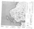
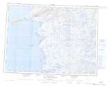
Maps showing Rivière Sorehead, Baie-d'Hudson; Kativik, Quebec

Rivière Sorehead is a River located in Baie-d'Hudson; Kativik, Quebec.

  • Latitude: 60° 33' 4'' North   (decimal: 60.5511055)
  • Longitude: 77° 30' 58'' West   (decimal: -77.5159927)
  • Topography Feature Category: River
  • Geographical Feature: Rivière
  • Canadian Province/Territory: Quebec
  • Location: Baie-d'Hudson; Kativik
  • Atlas of Canada Locator Map: Rivière Sorehead
  • GPS Coordinate Locator Map: Rivière Sorehead Lat/Long

Rivière Sorehead NTS Map Sheets

035C06 Lac Bistodeau Topographic Map at 1:50,000 scale

035C07 Lac Quukittuq Topographic Map at 1:50,000 scale

035C10 Lac Tasirjuarusiq Topographic Map at 1:50,000 scale

035C11 Lac Akunnimiutaq Topographic Map at 1:50,000 scale

035C12 Collines Amajurjuk Topographic Map at 1:50,000 scale

035C Povungnituk Topographic Map at 1:250,000 scale

 
Buy Topographic Maps DVD
Newsletter Sign-up

Yes, I want to receive map store discounts.


Bookmark and Share