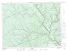
Maps showing Rivière South Branch, Rivière-Vaseuse; La Matapédia, Quebec
Rivière South Branch is a River located in Rivière-Vaseuse; La Matapédia, Quebec.
- Latitude: 48° 12' 27'' North (decimal: 48.2075480)
- Longitude: 67° 22' 55'' West (decimal: -67.3819320)
- Topography Feature Category: River
- Geographical Feature: Rivière
- Canadian Province/Territory: Quebec
- Location: Rivière-Vaseuse; La Matapédia
- GPS Coordinate Locator Map: Rivière South Branch Lat/Long