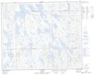
Maps showing Lac Stakel, Rivière-Mouchalagane; Caniapiscau, Quebec
Lac Stakel is a Lake located in Rivière-Mouchalagane; Caniapiscau, Quebec and has an elevation of 637 meters.
- Latitude: 52° 42' 0'' North (decimal: 52.7000000)
- Longitude: 67° 39' 14'' West (decimal: -67.6538888)
- Topography Feature Category: Lake
- Geographical Feature: Lac
- Canadian Province/Territory: Quebec
- Elevation: 637 meters
- Location: Rivière-Mouchalagane; Caniapiscau
- Atlas of Canada Locator Map: Lac Stakel
- GPS Coordinate Locator Map: Lac Stakel Lat/Long
Lac Stakel NTS Map Sheets