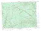
Maps showing Rivière Stewart, Carleton¿Saint-Omer; Avignon, Quebec
Rivière Stewart is a River located in Carleton¿Saint-Omer; Avignon, Quebec and has an elevation of 474 meters.
- Latitude: 48° 6' 25'' North (decimal: 48.1069939)
- Longitude: 66° 12' 50'' West (decimal: -66.2138365)
- Topography Feature Category: River
- Geographical Feature: Rivière
- Canadian Province/Territory: Quebec
- Elevation: 474 meters
- Location: Carleton¿Saint-Omer; Avignon
- Atlas of Canada Locator Map: Rivière Stewart
- GPS Coordinate Locator Map: Rivière Stewart Lat/Long
Rivière Stewart NTS Map Sheets