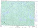
Maps showing Chenal du Sud, Senneterre; Vallée-de-l'Or, Quebec
Chenal du Sud is a Channel located in Senneterre; Vallée-de-l'Or, Quebec and has an elevation of 359 meters.
- Latitude: 47° 41' 0'' North (decimal: 47.6834121)
- Longitude: 76° 23' 14'' West (decimal: -76.3871676)
- Topography Feature Category: Channel
- Geographical Feature: Chenal
- Canadian Province/Territory: Quebec
- Elevation: 359 meters
- Location: Senneterre; Vallée-de-l'Or
- Atlas of Canada Locator Map: Chenal du Sud
- GPS Coordinate Locator Map: Chenal du Sud Lat/Long
Chenal du Sud NTS Map Sheets