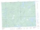
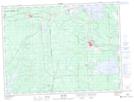
Maps showing Rivière Surimau, Lac-Fouillac; Vallée-de-l'Or, Quebec
Rivière Surimau is a River located in Lac-Fouillac; Vallée-de-l'Or, Quebec and has an elevation of 305 meters.
- Latitude: 47° 59' 42'' North (decimal: 47.9950909)
- Longitude: 78° 10' 59'' West (decimal: -78.1831024)
- Topography Feature Category: River
- Geographical Feature: Rivière
- Canadian Province/Territory: Quebec
- Elevation: 305 meters
- Location: Lac-Fouillac; Vallée-de-l'Or
- Atlas of Canada Locator Map: Rivière Surimau
- GPS Coordinate Locator Map: Rivière Surimau Lat/Long
Rivière Surimau NTS Map Sheets