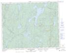
Maps showing Rivière Tabac, Lac-Walker; Sept-Rivières, Quebec
Rivière Tabac is a River located in Lac-Walker; Sept-Rivières, Quebec and has an elevation of 341 meters.
- Latitude: 51° 8' 19'' North (decimal: 51.1386111)
- Longitude: 66° 59' 34'' West (decimal: -66.9927778)
- Topography Feature Category: River
- Geographical Feature: Rivière
- Canadian Province/Territory: Quebec
- Elevation: 341 meters
- Location: Lac-Walker; Sept-Rivières
- Atlas of Canada Locator Map: Rivière Tabac
- GPS Coordinate Locator Map: Rivière Tabac Lat/Long
Rivière Tabac NTS Map Sheets