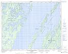
Maps showing Île Taché, Baie-James; Jamésie, Quebec
Île Taché is a Island located in Baie-James; Jamésie, Quebec and has an elevation of 393 meters.
- Latitude: 50° 53' 25'' North (decimal: 50.8902778)
- Longitude: 73° 49' 54'' West (decimal: -73.8316667)
- Topography Feature Category: Island
- Geographical Feature: Île / Ile
- Canadian Province/Territory: Quebec
- Elevation: 393 meters
- Location: Baie-James; Jamésie
- Atlas of Canada Locator Map: Île Taché
- GPS Coordinate Locator Map: Île Taché Lat/Long
Île Taché NTS Map Sheets