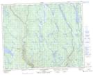
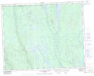
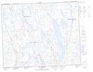
Maps showing Rivière Taoti, Rivière-Nipissis; Sept-Rivières, Quebec
Rivière Taoti is a River located in Rivière-Nipissis; Sept-Rivières, Quebec and has an elevation of 568 meters.
- Latitude: 51° 40' 38'' North (decimal: 51.6772816)
- Longitude: 66° 21' 28'' West (decimal: -66.3577067)
- Topography Feature Category: River
- Geographical Feature: Rivière
- Canadian Province/Territory: Quebec
- Elevation: 568 meters
- Location: Rivière-Nipissis; Sept-Rivières
- Atlas of Canada Locator Map: Rivière Taoti
- GPS Coordinate Locator Map: Rivière Taoti Lat/Long
Rivière Taoti NTS Map Sheets