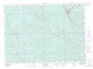
Maps showing Tee Lake, Kipawa; Témiscamingue, Quebec
Tee Lake is a Unincorporated area located in Kipawa; Témiscamingue, Quebec and has an elevation of 266 meters.
- Latitude: 46° 45' 21'' North (decimal: 46.7558333)
- Longitude: 79° 2' 40'' West (decimal: -79.0444444)
- Topography Feature Category: Unincorporated area
- Geographical Feature: Village
- Canadian Province/Territory: Quebec
- Elevation: 266 meters
- Location: Kipawa; Témiscamingue
- Atlas of Canada Locator Map: Tee Lake
- GPS Coordinate Locator Map: Tee Lake Lat/Long
Tee Lake NTS Map Sheets