Canada Topographic Maps

Lac Témiscamingue Topo Maps

Topography maps and Latitude/Longitude Location

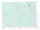
Maps showing Lac Témiscamingue, Saint-Édouard-de-Fabre; Témiscamingue, Quebec

Lac Témiscamingue is a Lake located in Saint-Édouard-de-Fabre; Témiscamingue, Quebec and has an elevation of 166 meters.

  • Latitude: 47° 10' 2'' North   (decimal: 47.1672942)
  • Longitude: 79° 26' 11'' West   (decimal: -79.4365022)
  • Topography Feature Category: Lake
  • Geographical Feature: Lac
  • Canadian Province/Territory: Quebec
  • Elevation: 166 meters
  • Location: Saint-Édouard-de-Fabre; Témiscamingue
  • Atlas of Canada Locator Map: Lac Témiscamingue
  • GPS Coordinate Locator Map: Lac Témiscamingue Lat/Long

Lac Témiscamingue NTS Map Sheets

031L11 Temiscaming Topographic Map at 1:50,000 scale

031L14 Ottertail Creek Topographic Map at 1:50,000 scale

031M03 Fabre Topographic Map at 1:50,000 scale

031M05 Cobalt Topographic Map at 1:50,000 scale

031M06 Ville-Marie Topographic Map at 1:50,000 scale

031M11 Angliers Topographic Map at 1:50,000 scale

031M12 New Liskeard Topographic Map at 1:50,000 scale

031L North Bay Topographic Map at 1:250,000 scale

031M Ville-Marie Topographic Map at 1:250,000 scale

 
Buy Topographic Maps DVD
Newsletter Sign-up

Yes, I want to receive map store discounts.


Bookmark and Share