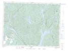
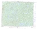
Maps showing Rivière de la Tête Blanche, Mont-Valin; Le Fjord-du-Saguenay, Quebec
Rivière de la Tête Blanche is a River located in Mont-Valin; Le Fjord-du-Saguenay, Quebec and has an elevation of 333 meters.
- Latitude: 48° 55' 51'' North (decimal: 48.9308748)
- Longitude: 71° 1' 3'' West (decimal: -71.0175781)
- Topography Feature Category: River
- Geographical Feature: Rivière
- Canadian Province/Territory: Quebec
- Elevation: 333 meters
- Location: Mont-Valin; Le Fjord-du-Saguenay
- Atlas of Canada Locator Map: Rivière de la Tête Blanche
- GPS Coordinate Locator Map: Rivière de la Tête Blanche Lat/Long
Rivière de la Tête Blanche NTS Map Sheets