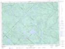
Maps showing Lac Thérèse, Lac-Normand; Mékinac, Quebec
Lac Thérèse is a Lake located in Lac-Normand; Mékinac, Quebec and has an elevation of 415 meters.
- Latitude: 47° 3' 7'' North (decimal: 47.0519444)
- Longitude: 73° 11' 31'' West (decimal: -73.1919444)
- Topography Feature Category: Lake
- Geographical Feature: Lac
- Canadian Province/Territory: Quebec
- Elevation: 415 meters
- Location: Lac-Normand; Mékinac
- Atlas of Canada Locator Map: Lac Thérèse
- GPS Coordinate Locator Map: Lac Thérèse Lat/Long
Lac Thérèse NTS Map Sheets