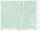
Maps showing Ruisseau Thomas, Rivière-aux-Outardes; Manicouagan, Quebec
Ruisseau Thomas is a River located in Rivière-aux-Outardes; Manicouagan, Quebec and has an elevation of 492 meters.
- Latitude: 50° 56' 13'' North (decimal: 50.9369669)
- Longitude: 68° 50' 31'' West (decimal: -68.8419577)
- Topography Feature Category: River
- Geographical Feature: Ruisseau
- Canadian Province/Territory: Quebec
- Elevation: 492 meters
- Location: Rivière-aux-Outardes; Manicouagan
- Atlas of Canada Locator Map: Ruisseau Thomas
- GPS Coordinate Locator Map: Ruisseau Thomas Lat/Long
Ruisseau Thomas NTS Map Sheets