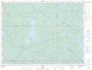
Maps showing Timbrell, La Tuque; Le Haut-Saint-Maurice, Quebec
Timbrell is a Unincorporated area located in La Tuque; Le Haut-Saint-Maurice, Quebec and has an elevation of 440 meters.
- Latitude: 47° 58' 4'' North (decimal: 47.9677778)
- Longitude: 74° 45' 51'' West (decimal: -74.7641667)
- Topography Feature Category: Unincorporated area
- Geographical Feature: Arrêt ferroviaire
- Canadian Province/Territory: Quebec
- Elevation: 440 meters
- Location: La Tuque; Le Haut-Saint-Maurice
- Atlas of Canada Locator Map: Timbrell
- GPS Coordinate Locator Map: Timbrell Lat/Long