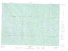
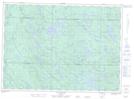
Maps showing Ruisseau Tomo, Lac-Nilgaut; Pontiac, Quebec
Ruisseau Tomo is a River located in Lac-Nilgaut; Pontiac, Quebec and has an elevation of 311 meters.
- Latitude: 46° 28' 25'' North (decimal: 46.4736697)
- Longitude: 76° 47' 43'' West (decimal: -76.7952634)
- Topography Feature Category: River
- Geographical Feature: Ruisseau
- Canadian Province/Territory: Quebec
- Elevation: 311 meters
- Location: Lac-Nilgaut; Pontiac
- Atlas of Canada Locator Map: Ruisseau Tomo
- GPS Coordinate Locator Map: Ruisseau Tomo Lat/Long
Ruisseau Tomo NTS Map Sheets