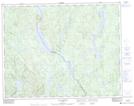
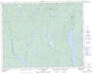
Maps showing Rivière Toulnustouc Nord, Lac-Walker; Sept-Rivières, Quebec
Rivière Toulnustouc Nord is a River located in Lac-Walker; Sept-Rivières, Quebec and has an elevation of 453 meters.
- Latitude: 51° 6' 48'' North (decimal: 51.1133445)
- Longitude: 67° 45' 29'' West (decimal: -67.7580673)
- Topography Feature Category: River
- Geographical Feature: Rivière
- Canadian Province/Territory: Quebec
- Elevation: 453 meters
- Location: Lac-Walker; Sept-Rivières
- Atlas of Canada Locator Map: Rivière Toulnustouc Nord
- GPS Coordinate Locator Map: Rivière Toulnustouc Nord Lat/Long
Rivière Toulnustouc Nord NTS Map Sheets