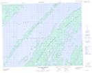
Maps showing Île Traill, Baie-James; Jamésie, Quebec
Île Traill is a Island located in Baie-James; Jamésie, Quebec.
- Latitude: 51° 9' 2'' North (decimal: 51.1505556)
- Longitude: 73° 5' 26'' West (decimal: -73.0905556)
- Topography Feature Category: Island
- Geographical Feature: Île / Ile
- Canadian Province/Territory: Quebec
- Location: Baie-James; Jamésie
- Atlas of Canada Locator Map: Île Traill
- GPS Coordinate Locator Map: Île Traill Lat/Long
Île Traill NTS Map Sheets