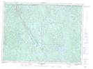
Maps showing Ruisseau Tremblay, Lac-Pikauba; Charlevoix, Quebec
Ruisseau Tremblay is a River located in Lac-Pikauba; Charlevoix, Quebec and has an elevation of 749 meters.
- Latitude: 47° 57' 36'' North (decimal: 47.96)
- Longitude: 71° 22' 25'' West (decimal: -71.3736111)
- Topography Feature Category: River
- Geographical Feature: Ruisseau
- Canadian Province/Territory: Quebec
- Elevation: 749 meters
- Location: Lac-Pikauba; Charlevoix
- Atlas of Canada Locator Map: Ruisseau Tremblay
- GPS Coordinate Locator Map: Ruisseau Tremblay Lat/Long
Ruisseau Tremblay NTS Map Sheets