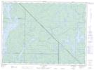
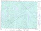
Maps showing Rivière Trout, Lac-Pythonga; La Vallée-de-la-Gatineau, Quebec
Rivière Trout is a River located in Lac-Pythonga; La Vallée-de-la-Gatineau, Quebec.
- Latitude: 47° 21' 17'' North (decimal: 47.3547933)
- Longitude: 76° 18' 40'' West (decimal: -76.3110532)
- Topography Feature Category: River
- Geographical Feature: Rivière
- Canadian Province/Territory: Quebec
- Location: Lac-Pythonga; La Vallée-de-la-Gatineau
- GPS Coordinate Locator Map: Rivière Trout Lat/Long
Rivière Trout NTS Map Sheets