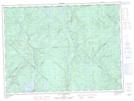
Maps showing Rivière Trout, La Tuque; Le Haut-Saint-Maurice, Quebec
Rivière Trout is a River located in La Tuque; Le Haut-Saint-Maurice, Quebec.
- Latitude: 47° 51' 40'' North (decimal: 47.8611552)
- Longitude: 72° 52' 20'' West (decimal: -72.8723334)
- Topography Feature Category: River
- Geographical Feature: Rivière
- Canadian Province/Territory: Quebec
- Location: La Tuque; Le Haut-Saint-Maurice
- GPS Coordinate Locator Map: Rivière Trout Lat/Long
Rivière Trout NTS Map Sheets