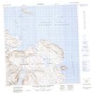
Maps showing Colline Tuaapaaluit, Rivière-Koksoak; Kativik, Quebec
Colline Tuaapaaluit is a Mountain located in Rivière-Koksoak; Kativik, Quebec.
- Latitude: 62° 8' 8'' North (decimal: 62.1355599)
- Longitude: 72° 44' 23'' West (decimal: -72.7397241)
- Topography Feature Category: Mountain
- Geographical Feature: Colline
- Canadian Province/Territory: Quebec
- Location: Rivière-Koksoak; Kativik
- Atlas of Canada Locator Map: Colline Tuaapaaluit
- GPS Coordinate Locator Map: Colline Tuaapaaluit Lat/Long
Colline Tuaapaaluit NTS Map Sheets