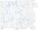
Maps showing Lac Tuttle, Rivière-Mouchalagane; Caniapiscau, Quebec
Lac Tuttle is a Lake located in Rivière-Mouchalagane; Caniapiscau, Quebec and has an elevation of 619 meters.
- Latitude: 52° 34' 37'' North (decimal: 52.5769444)
- Longitude: 67° 39' 31'' West (decimal: -67.6586111)
- Topography Feature Category: Lake
- Geographical Feature: Lac
- Canadian Province/Territory: Quebec
- Elevation: 619 meters
- Location: Rivière-Mouchalagane; Caniapiscau
- Atlas of Canada Locator Map: Lac Tuttle
- GPS Coordinate Locator Map: Lac Tuttle Lat/Long
Lac Tuttle NTS Map Sheets