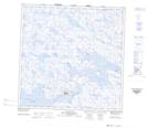
Maps showing Lac Uivarqat, Puvirnituq; Kativik, Quebec
Lac Uivarqat is a Lake located in Puvirnituq; Kativik, Quebec and has an elevation of 26 meters.
- Latitude: 60° 2' 51'' North (decimal: 60.0474812)
- Longitude: 77° 21' 24'' West (decimal: -77.3567865)
- Topography Feature Category: Lake
- Geographical Feature: Lac
- Canadian Province/Territory: Quebec
- Elevation: 26 meters
- Location: Puvirnituq; Kativik
- Atlas of Canada Locator Map: Lac Uivarqat
- GPS Coordinate Locator Map: Lac Uivarqat Lat/Long
Lac Uivarqat NTS Map Sheets