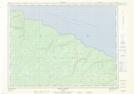
Maps showing Pointe à la Vache, L'Île-d'Anticosti; Minganie, Quebec
Pointe à la Vache is a Cape located in L'Île-d'Anticosti; Minganie, Quebec and has an elevation of 3 meters.
- Latitude: 49° 41' 55'' North (decimal: 49.6986792)
- Longitude: 62° 51' 21'' West (decimal: -62.8559562)
- Topography Feature Category: Cape
- Geographical Feature: Pointe
- Canadian Province/Territory: Quebec
- Elevation: 3 meters
- Location: L'Île-d'Anticosti; Minganie
- Atlas of Canada Locator Map: Pointe à la Vache
- GPS Coordinate Locator Map: Pointe à la Vache Lat/Long
Pointe à la Vache NTS Map Sheets