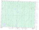
Maps showing Rivière Vassal, Lac-Despinassy; Abitibi, Quebec
Rivière Vassal is a River located in Lac-Despinassy; Abitibi, Quebec and has an elevation of 305 meters.
- Latitude: 48° 54' 43'' North (decimal: 48.9119444)
- Longitude: 77° 34' 30'' West (decimal: -77.575)
- Topography Feature Category: River
- Geographical Feature: Rivière
- Canadian Province/Territory: Quebec
- Elevation: 305 meters
- Location: Lac-Despinassy; Abitibi
- Atlas of Canada Locator Map: Rivière Vassal
- GPS Coordinate Locator Map: Rivière Vassal Lat/Long
Rivière Vassal NTS Map Sheets