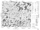
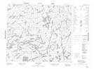
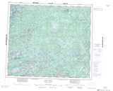
Maps showing Lac Vaujours, Rivière-Koksoak; Kativik, Quebec
Lac Vaujours is a Lake located in Rivière-Koksoak; Kativik, Quebec.
- Latitude: 55° 27' 56'' North (decimal: 55.4655556)
- Longitude: 70° 33' 32'' West (decimal: -70.5588889)
- Topography Feature Category: Lake
- Geographical Feature: Lac
- Canadian Province/Territory: Quebec
- Location: Rivière-Koksoak; Kativik
- Atlas of Canada Locator Map: Lac Vaujours
- GPS Coordinate Locator Map: Lac Vaujours Lat/Long
Lac Vaujours NTS Map Sheets