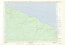
Maps showing Chute Vauréal, L'Île-d'Anticosti; Minganie, Quebec
Chute Vauréal is a Falls located in L'Île-d'Anticosti; Minganie, Quebec and has an elevation of 132 meters.
- Latitude: 49° 33' 40'' North (decimal: 49.5611858)
- Longitude: 62° 42' 33'' West (decimal: -62.7092905)
- Topography Feature Category: Falls
- Geographical Feature: Chute
- Canadian Province/Territory: Quebec
- Elevation: 132 meters
- Location: L'Île-d'Anticosti; Minganie
- Atlas of Canada Locator Map: Chute Vauréal
- GPS Coordinate Locator Map: Chute Vauréal Lat/Long
Chute Vauréal NTS Map Sheets